Highland Ecuador
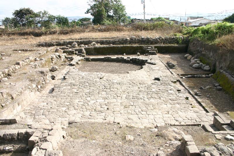
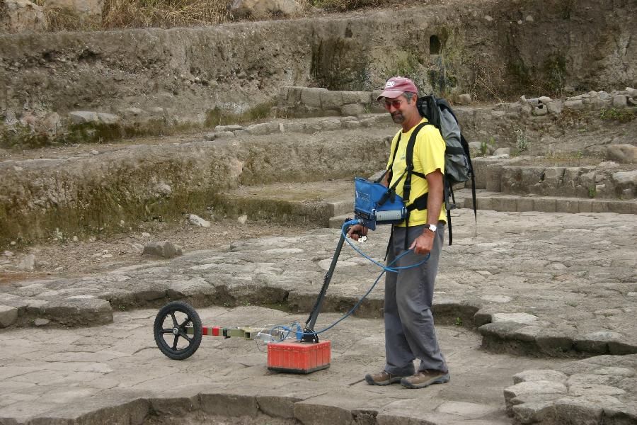
Working with Tammy Bray from Wayne State University (and with help in data collection from Brian McCray) I collected GPR data at a site called Inca-Caranqui, which is suggested to be the palace of Atahualpa. This is a very impressive "sunken plaza", which has also been described as a "swimming pool", buy others. See the amazing stone work in this floor, below:
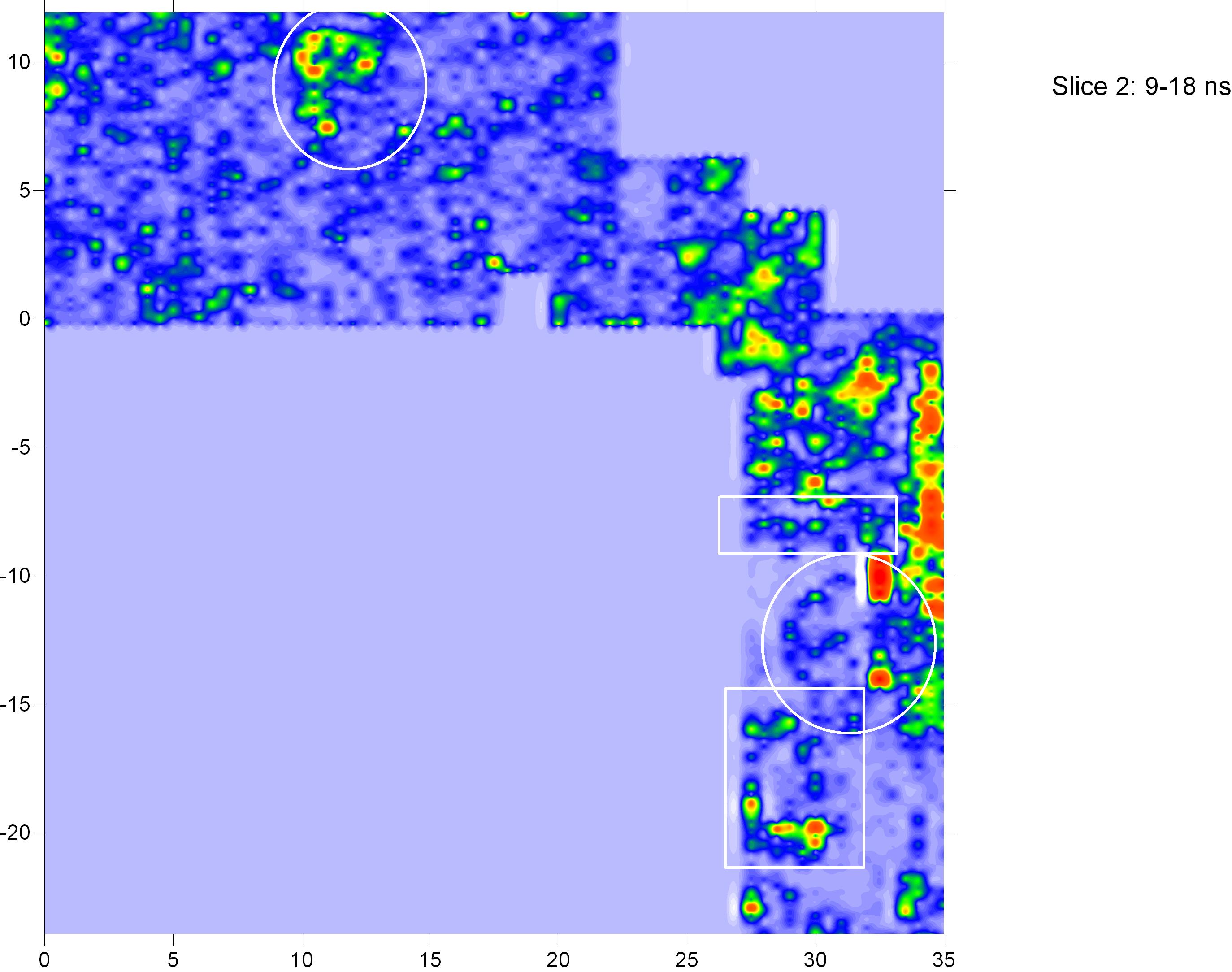
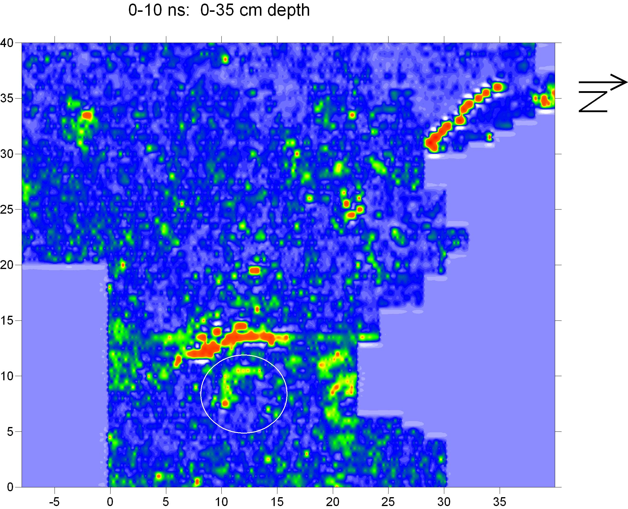
We collected data all around the edge of this feature, and found a number of "rooms and features" around the edge of this sunken plaza, which Tammy has excavated and found to be Inca in age. They are circled in white on the amplitude map below:
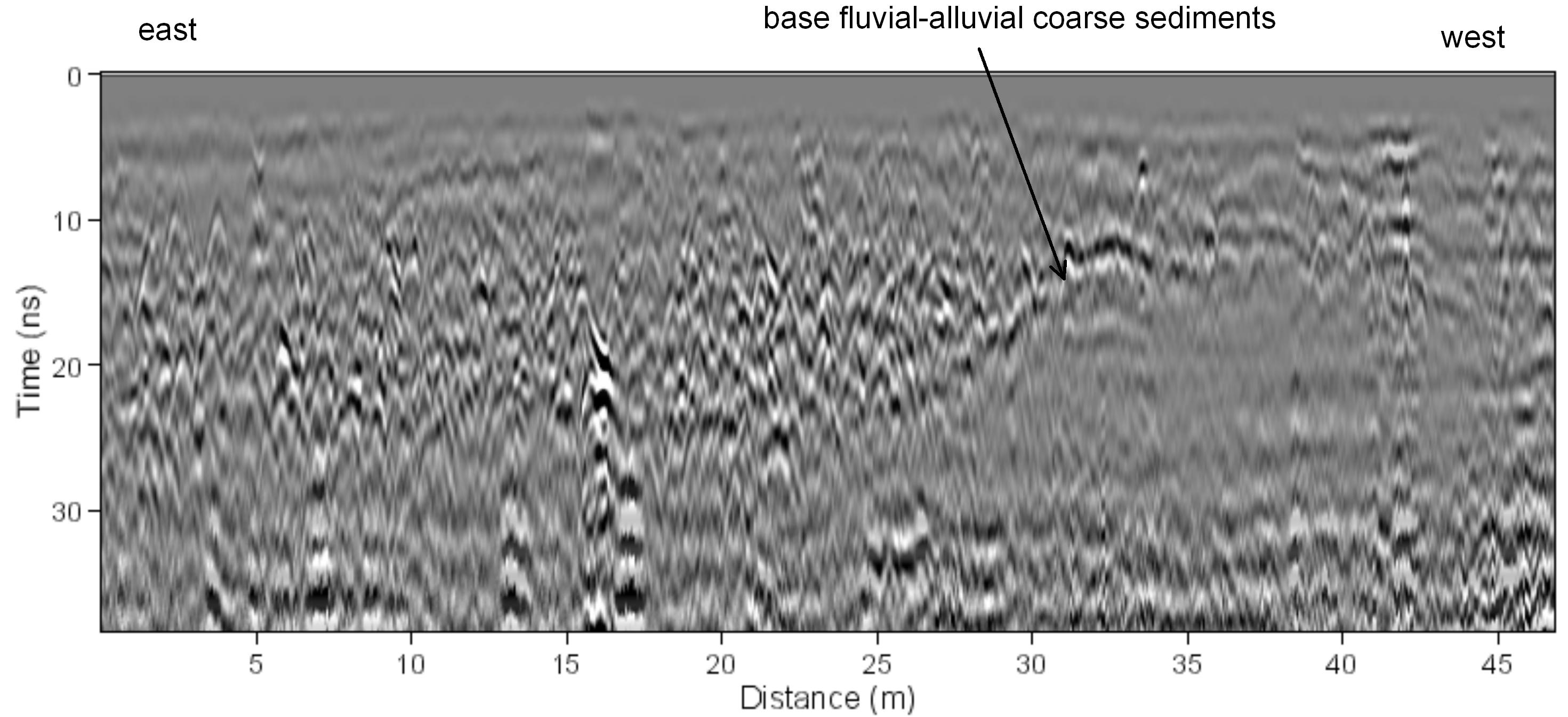
Much of the area surveyed turned out to be fluvial sediments from an alluvial fan, with no archaeological features found:
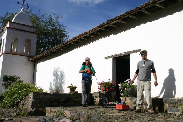
I also visited my friends Sam Connell (Foothill College) and Chad Gifford (Columbia University) at their field school at Pambamarca. We collected some GPR data in the Capilla (chapel) at the Hacienda Guachila.
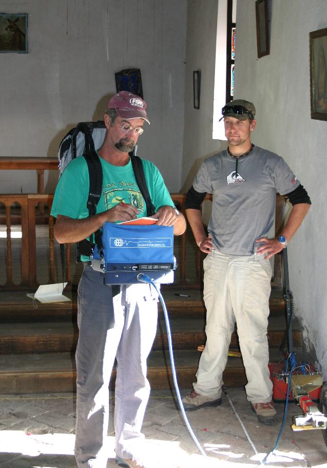
The reflection profiles were super, and the graves under the floor of the chapel were quite distinct.
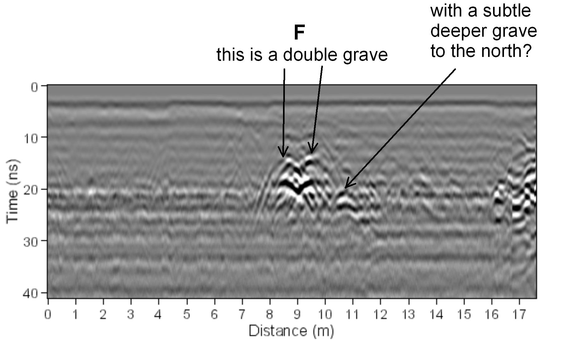
A whole bunch of graves were visible in the floor, of unknown age. The leveling fill under the floor was also visible. Graves are labeled A through G.
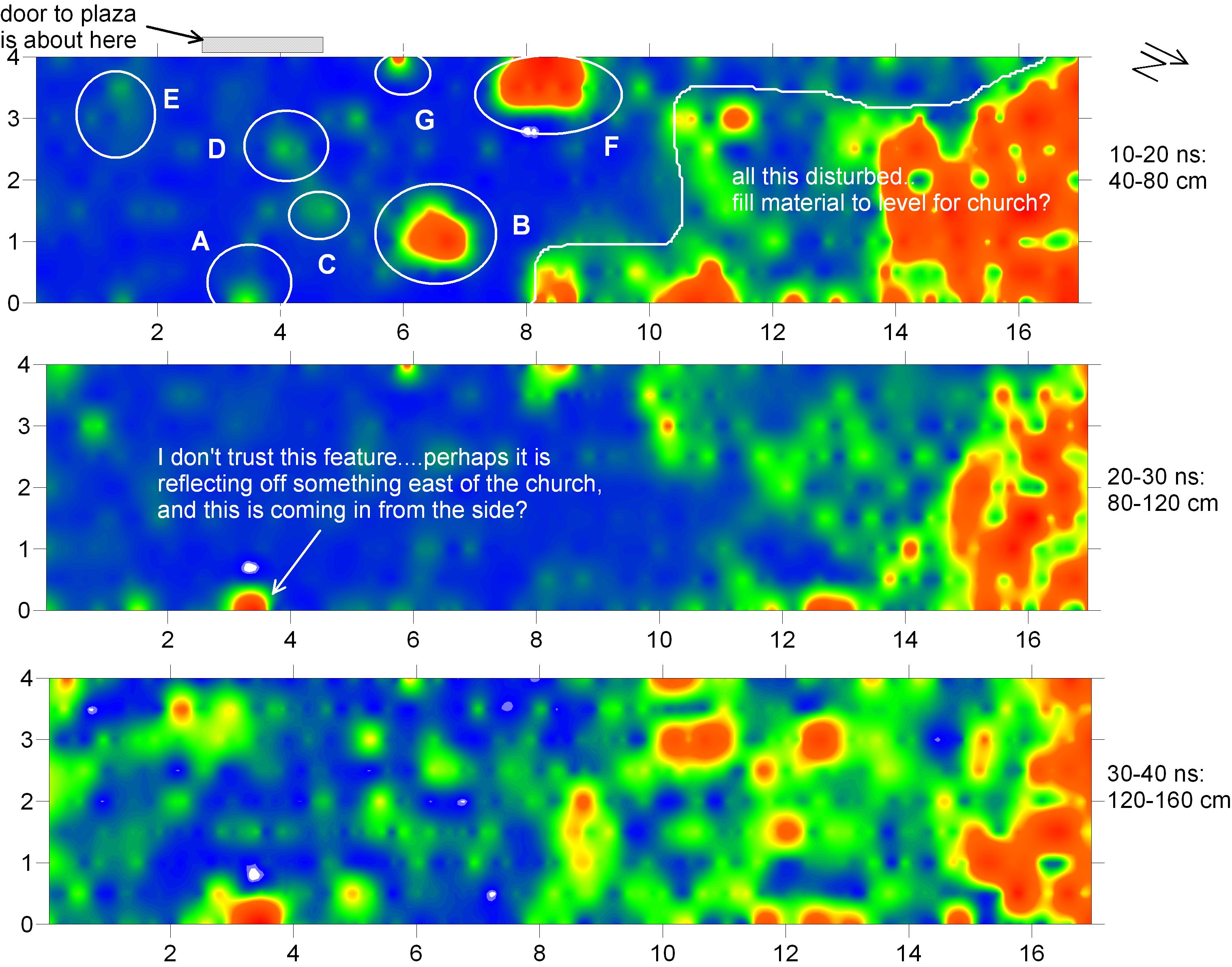
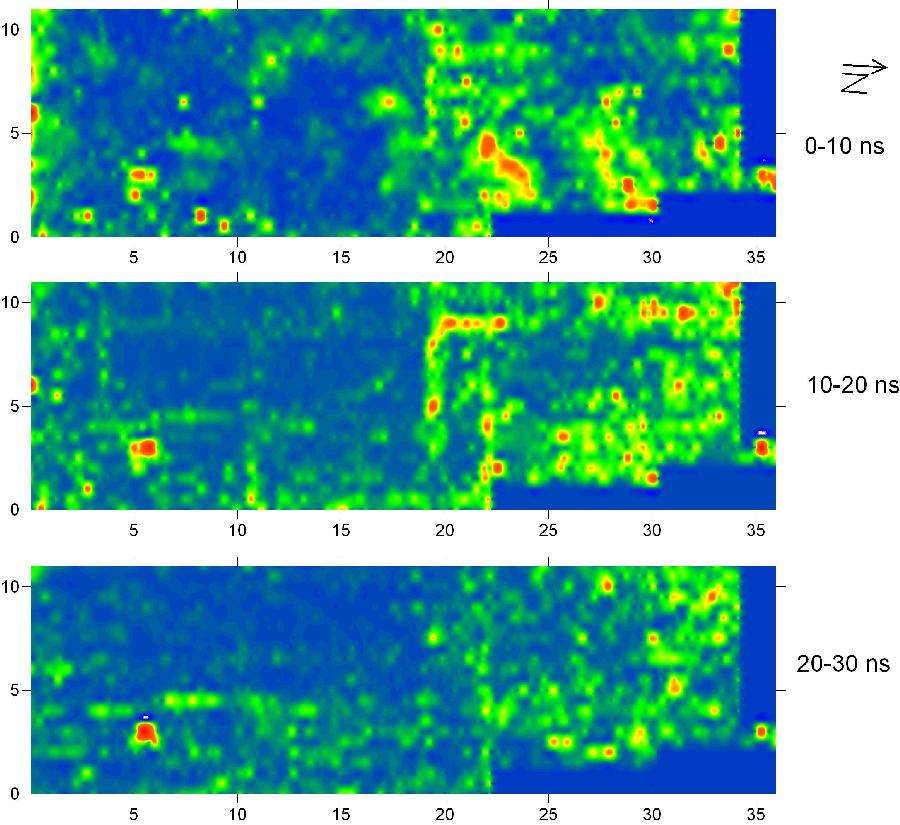
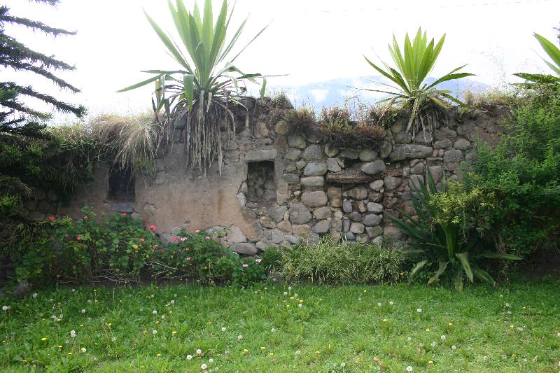
Back at Caranqui we collected a grid of data in the backyard of one of the nearby residents. An Inca wall is still standing here, so we were curious if there were other remains still preserved in the ground. There were!
The amplitude maps show the foundations of what are likely Inca houses (perhaps waddle and daub buildings), which were likely related to the nearby elite quarters just across the modern street. The foundations are nicely visible in the 10-20 ns slice.