Highland Ethiopia
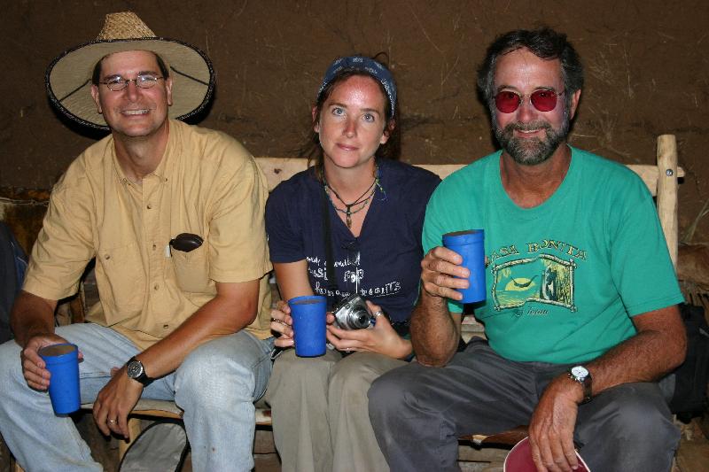
In 2008 I joined John and Katherine Arthur in the Gamo area of the western highland of Ethiopia to study historic and prehistoric sites. The idea was to find buried sites from that past that might be able to document the past caste system in these people's cultures. My job was to find these sites in complex slump blocks in this mountainous region. This is John on the left, and Amanda in the middle, where we were sampling the local lumpy beer, made from some mystery grains brewed in a jar in the back room:
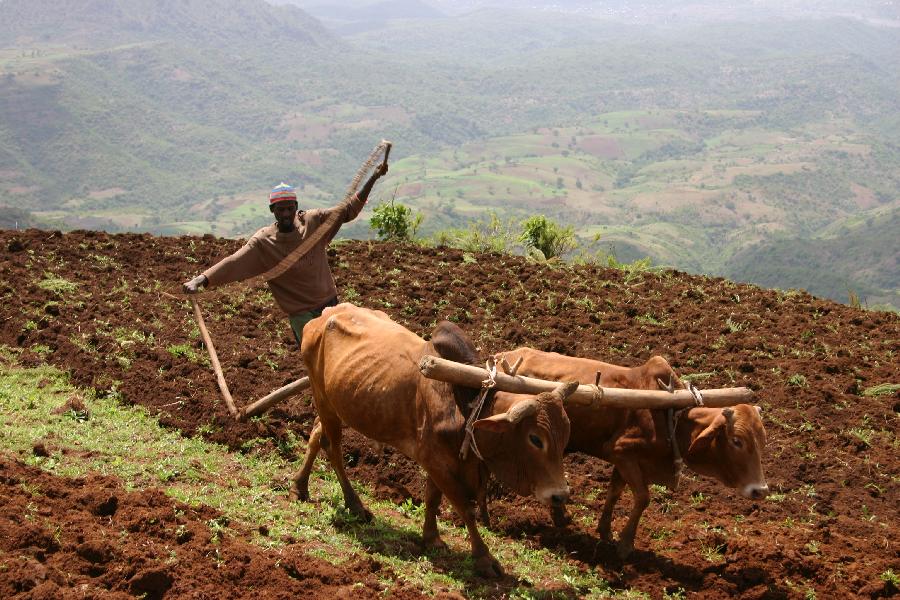
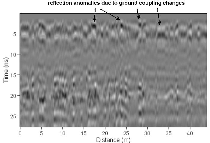
The ground was very poor for GPR, with much of it having been recently plowed. In fact, when the local people heard we were in the area, they spent huge amounts of time plowing the land, so as to show their "ownership" of the land (in the hope that the government would not take it away from them, if we were "interested" in it)....a sad state of affairs!
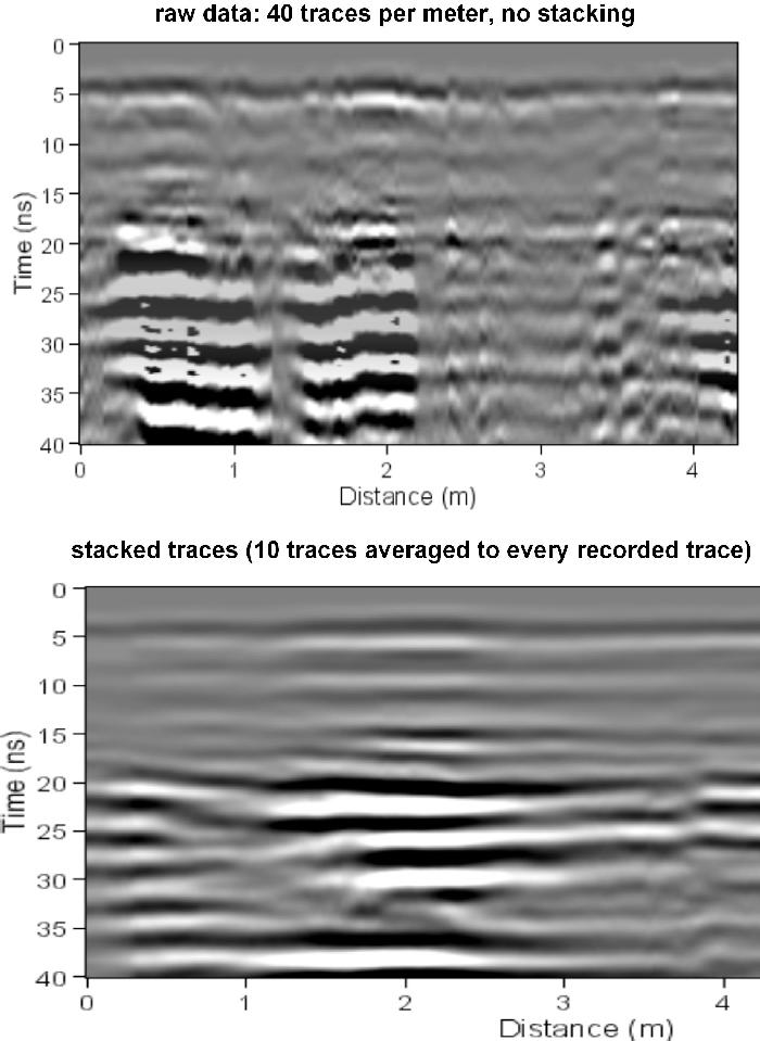
As a result many of the reflection profiles showed huge numbers of coupling changes as the antennas bumped over the ground.
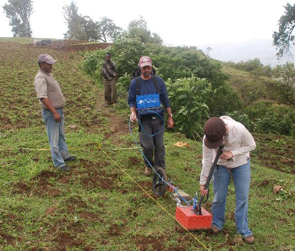
This necessitated post-collection processing to "stack" reflections and remove all these coupling anomalies. This tended to also smooth the subsurface reflections, sometimes making them a little "blurry", but removing reflections that were as result of the ground surface changes.
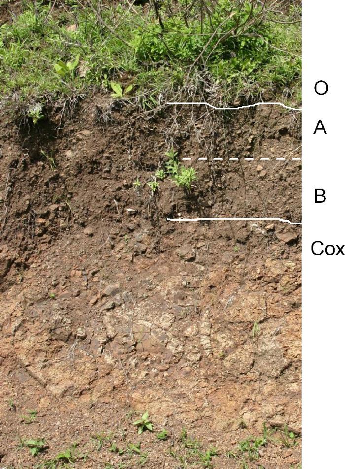
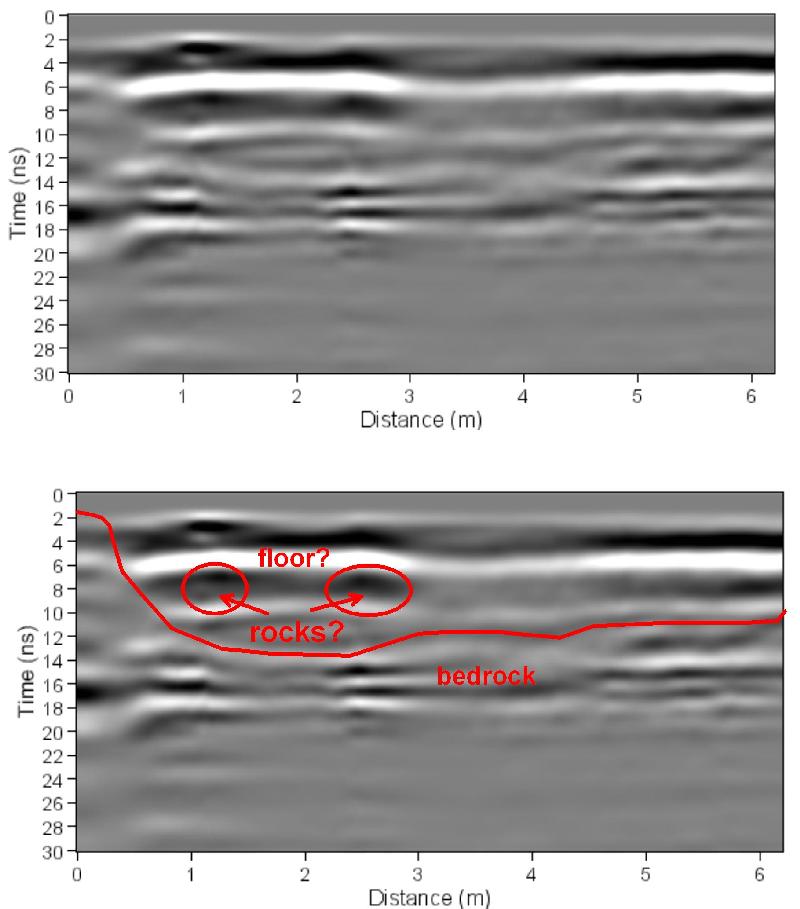
The soil profiles were quite shallow in this area, and most of the stone features we were interested in were at near contact of the A and B horizons. The bedrock is basalt, which can be seen in most profiles, even when highly weathered (Cox).
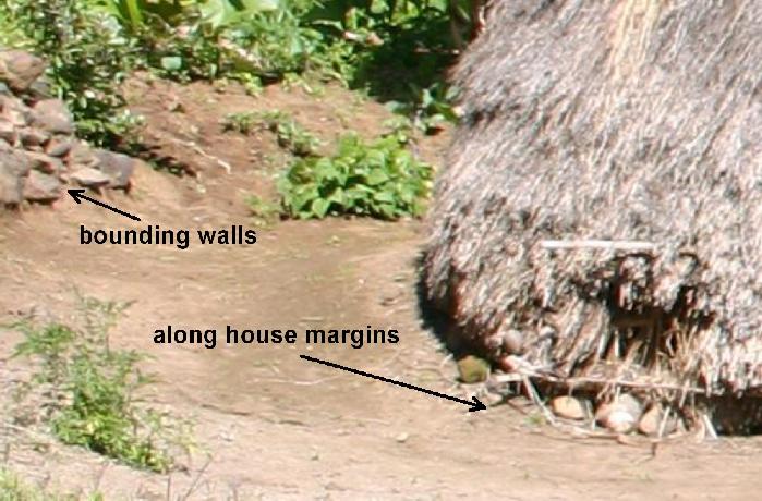
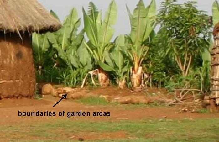
I also spent some time doing an "ethnography" of stones, and how they are used today in traditional houses and other built features nearby. This was necessary in order to interpret the GPR maps when they were constructed. Stones are often used in bounding walls and as house foundations, and have very distinctive geometries.
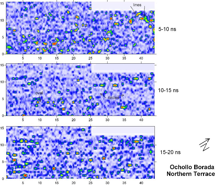
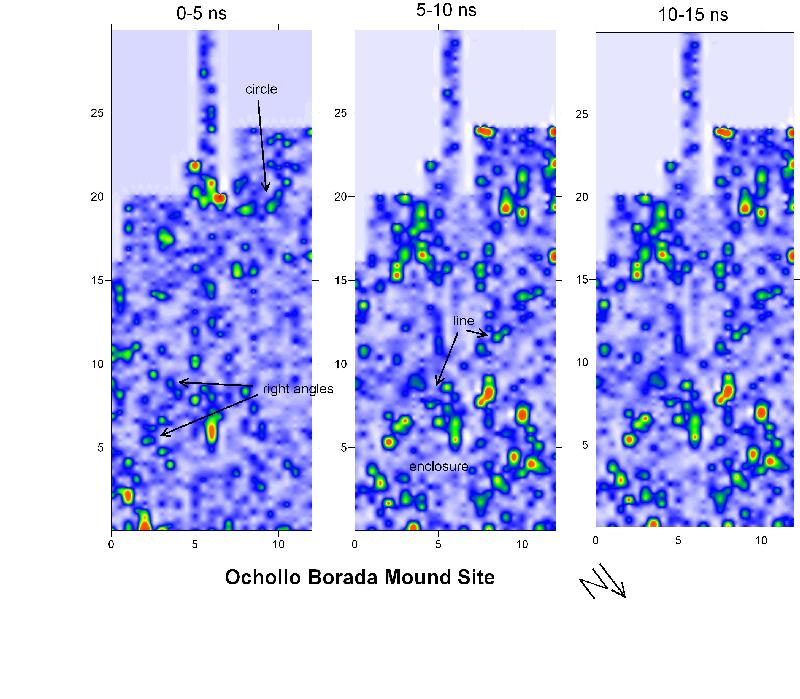
With that information I then looked for similar geometric patterns in the amplitude slice maps, generated at the correct soil horizon for each of the sites. Here are some of the amplitude maps showing these distinctive buried features:
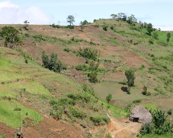
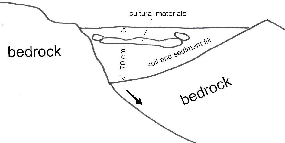
At times the landscape was very complex, with recent slump blocks containing shallow basins, where the archaeological materials are preserved. Here is a modern house built in one of these slump blocks as an analogy:
This is the model for how these features look in cross section.
These same features can be seen in GPR reflection profiles:
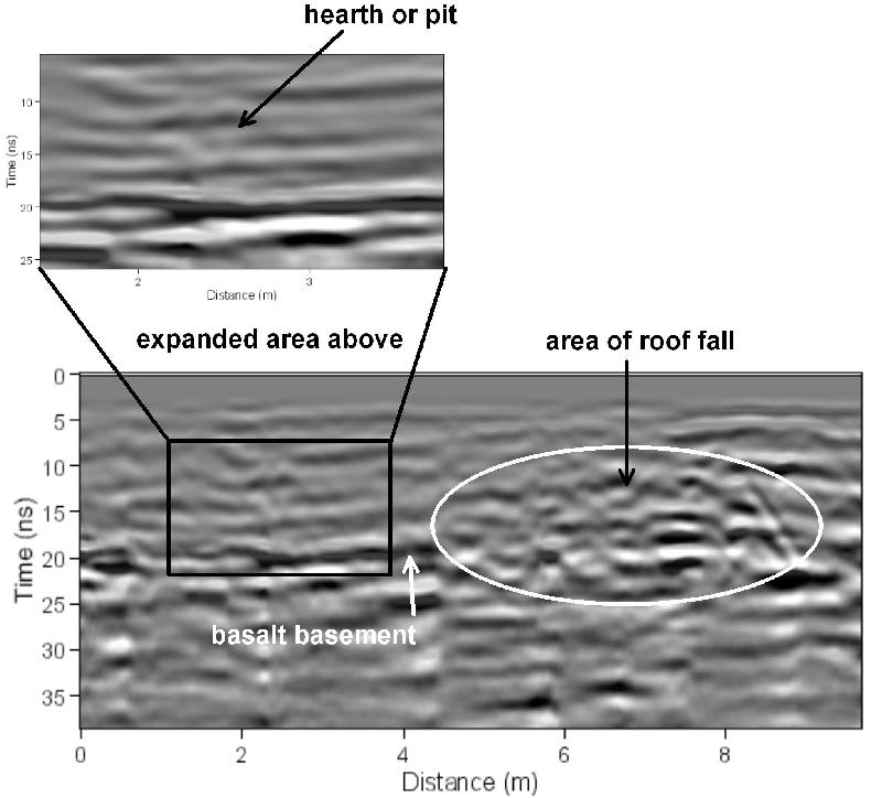
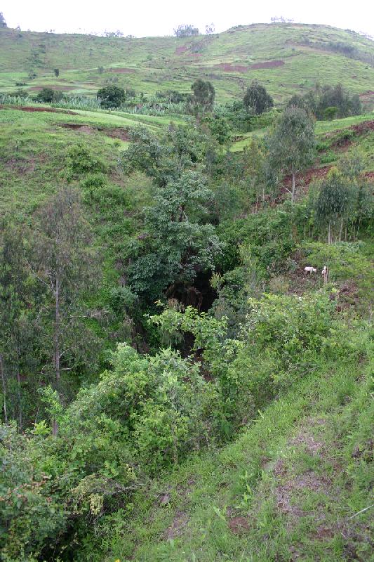
Then as a change of pace, we hiked down to Tuwatey Cave to test GPR in the protected cave sediments.
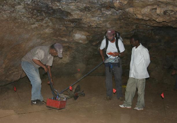
We collected a very tight grid in this cave using the 400 MHz antennas.
The GPR reflections are great, and many complicated features can be seen in this sediment package including roof fall and hearths. Here is just one example: