Hawaiian GPR studies:
In December, 2005 I worked with Sam Connell and the Joint POW/MIA Accounting Command at Hickam Air Force Base developing GPR techniques for mapping graves and other shallow archaeological sites. Sam now teaches at Foothills College in Los Altos, California.
Our goals were to test the GPR method’s
effectiveness in mapping buried archaeological sites and to prospect for modern
and ancient human burials at a number of test areas on
Here are some of the sites we worked on, with some images:
Weathered coral soils
A number of grids of data were collected at Hickam Air Force Base in
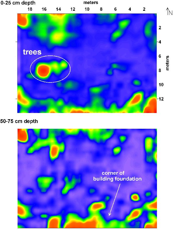
This is a reflection profile across what we think is a part of her house:
And when you look at all the profiles in a slice-map, this is the foundation reflection in map view:
Most of our tests in the Hickam area were located 100 meters or more inland from the bay, and good GPR reflection data indicated that the ground water in this area was mostly fresh. There was little energy attenuation within the time window that data were collected, with good reflections recorded to at least 2 meters depth.
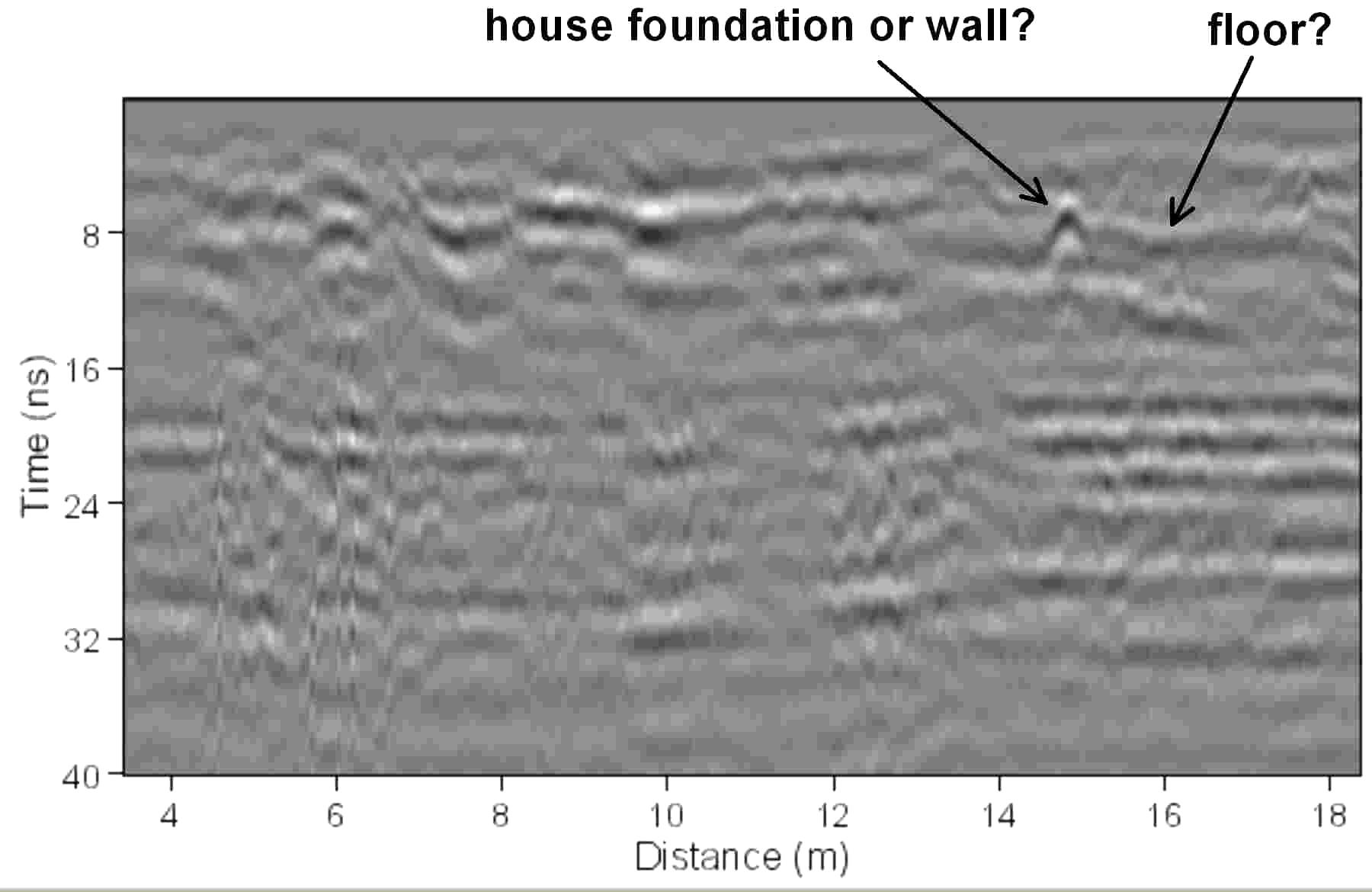
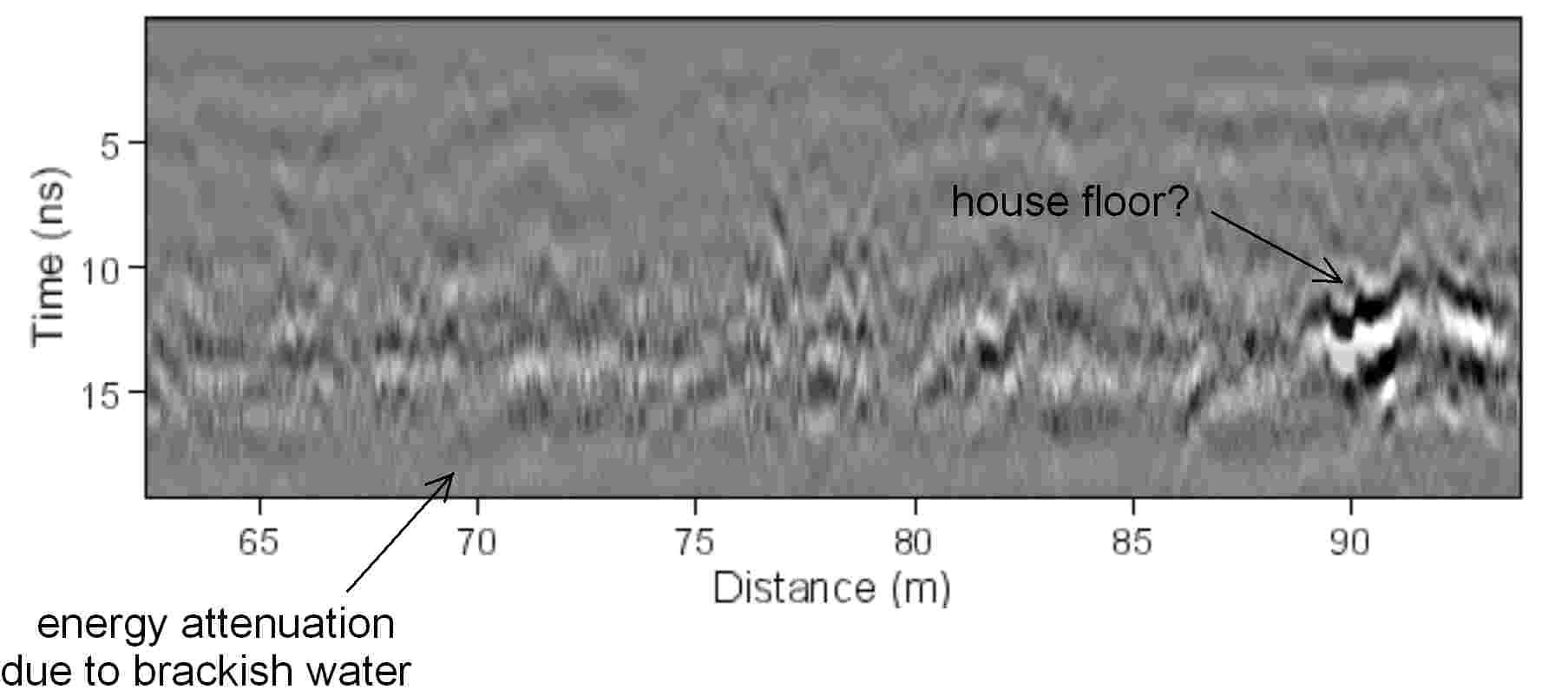
In a similar near-shore carbonate setting a test was conducted in a vacant lot in the Waikiki District that was slated for construction The GPR reflection profiles in this location showed good radar reflections in profile, discovering a possible house floor or other historic feature at about 1 meter depth, which is about 12 nanoseconds in two-way radar travel time. Below that level the brackish groundwater appears to have attenuated all radar energy.
Carbonate
dunes
The numerous coral and shell fragments that make up dunes in low lying
areas of the coast, as well as most of the modern Hawaiian beaches were also
tested to determine resolution and depth penetration.
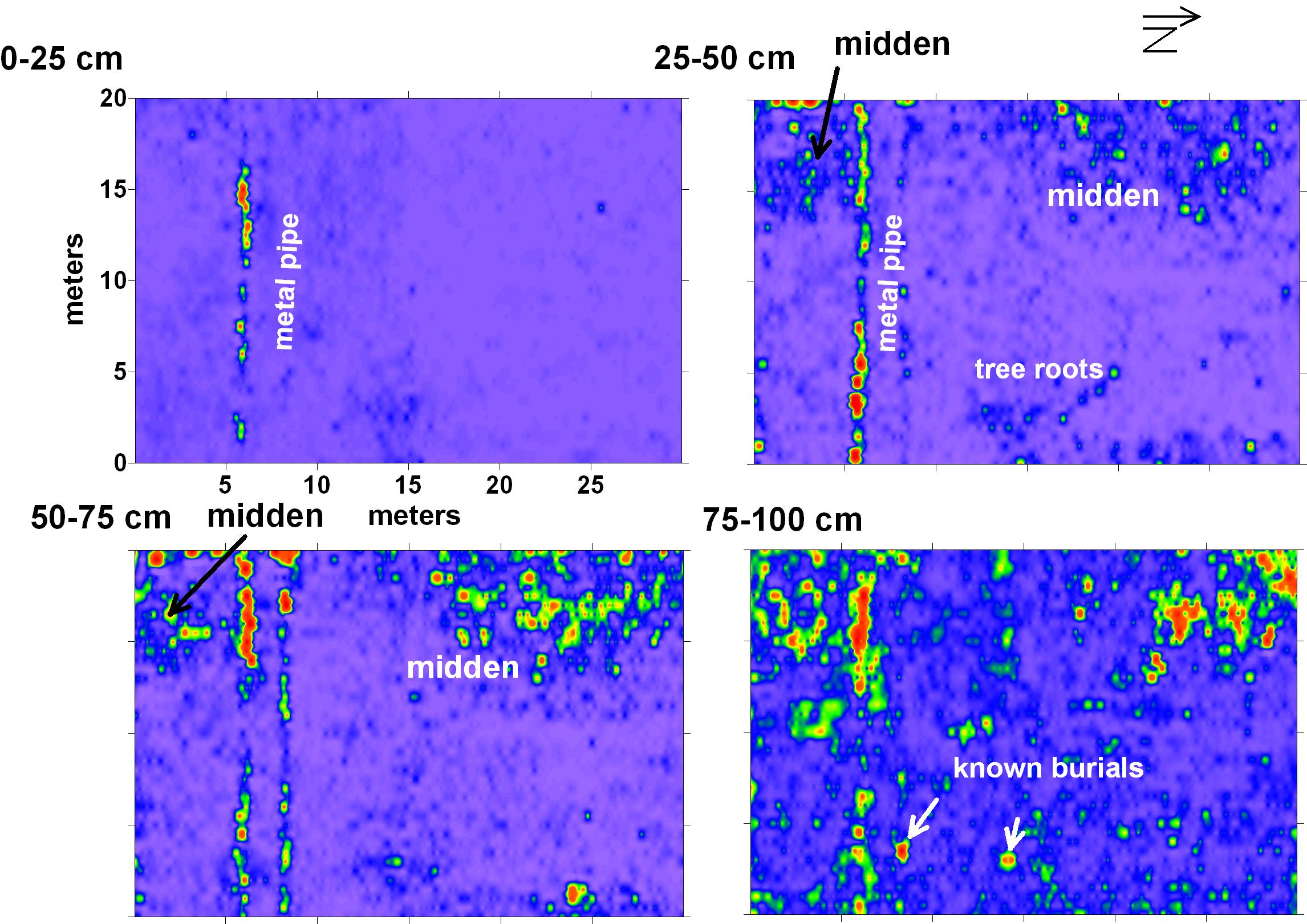
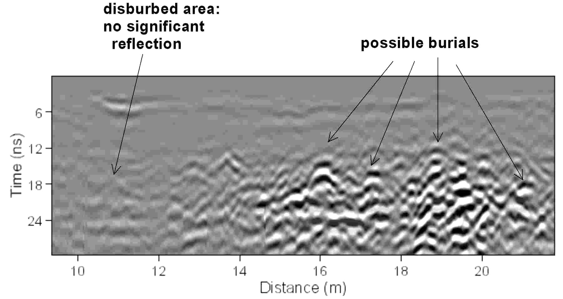
A 20x30 meter grid of GPR reflection data was collected using the 400 MHz
antennas with 50 centimeter profile spacing at Bellows Air Force Base on
And here are amplitude slice-maps of all the profiles in this grid, showing the pipe, but also burials and the midden deposits:
As active carbonate dunes can often contain archaeological materials
along the coast, test profiles were collected along the modern beach at the
Marine Corps Base Hawaii, also on the windward side of
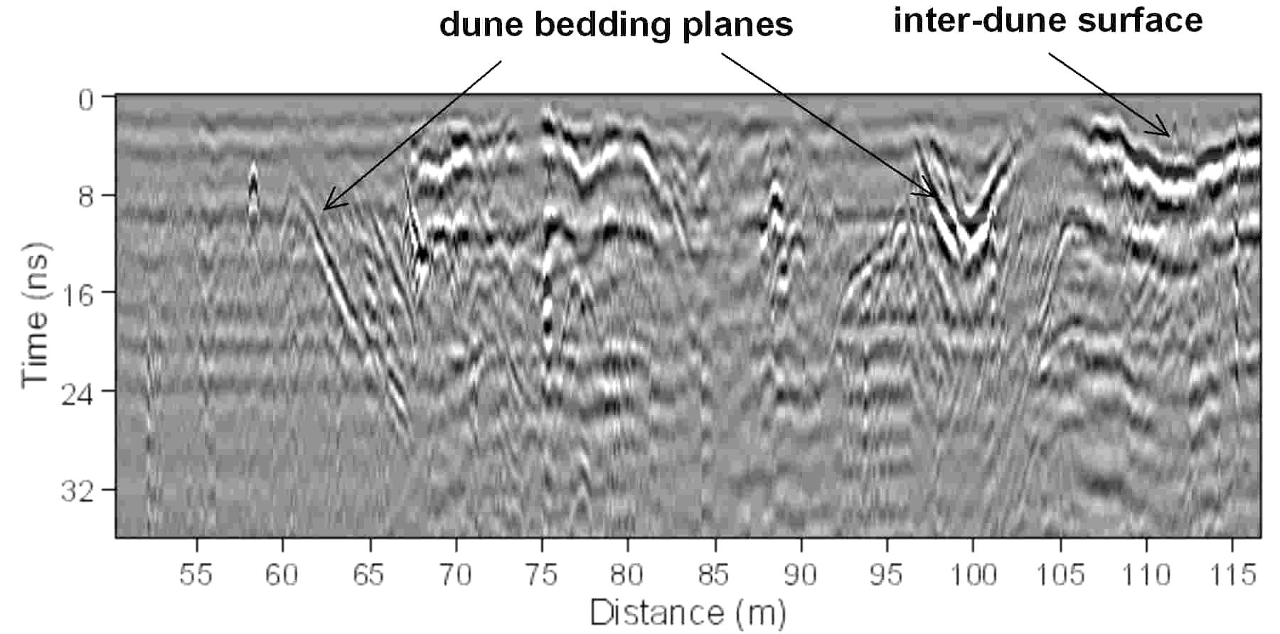
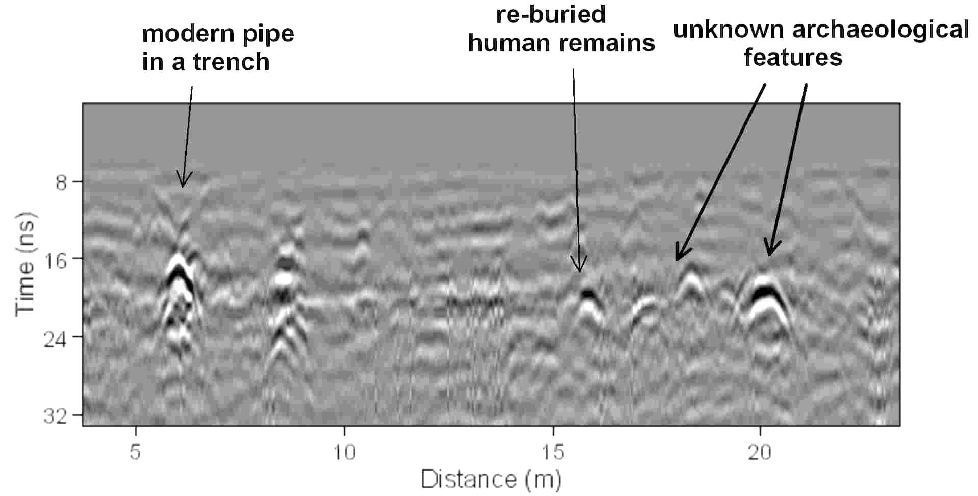
Ancient Hawaiian burials were often placed in sand dunes both along the
coast and in dune deposits farther inland. Just
south of the runway at Dillingham Air Field on
Weathered
basaltic soils
As most of the Hawaiian island chain’s bedrock is composed of basalt it
is important to understand GPR energy penetration in soils that have formed on
this material, as well as energy propagation within the volcanic rock.
An understanding of the electrical properties of the weathering products
formed from basalt, which can produce the thick reddish-brown clay soils visible
throughout the islands is therefore crucial.
Hawaiian basalt is composed of silica, plagioclase feldspar (sodium and
calcium aluminum silicates) and iron-magnesium minerals such as magnetite,
pyroxene and olivine. The
silica in the basalts is mostly stable over time, and its chemical composition
affects radar energy very little. The
feldspar minerals in basalt, however, will readily weather to a variety of clay
minerals depending on the environment conditions, with kaolonite clays formed in
the more humid windward areas and allophane, spectite and montmorillonite clays
in the drier leeward areas. The
most common way to measure the electrical conductivity of soils is by measuring
cation exchange capacity (CEC), a common measurement used in determining soil
fertility for agriculture. The
higher the CEC, the greater the electrical conductivity, as measured in units of
centimeters of cation change per kilogram. Kaolinite
has the lowest CEC of common Hawaiian soils, in the range of 2 to 15 cm/kg,
while montmorillonite has the highest (ranging from 80 to 150). The
calcium carbonate found in soils in leeward areas will also increase the
electrical conductivity when wet, as this mineral constituent can mobilize
cations. Therefore in a basic way
the clay soils formed on basalt in leeward locations will have poorer radar
energy propagation, as these electrically conductive soils will destroy most
radar energy readily in the ground. As
the soils become progressively more weathered because of greater rainfall toward
the windward areas, radar energy depth penetration will improve. As
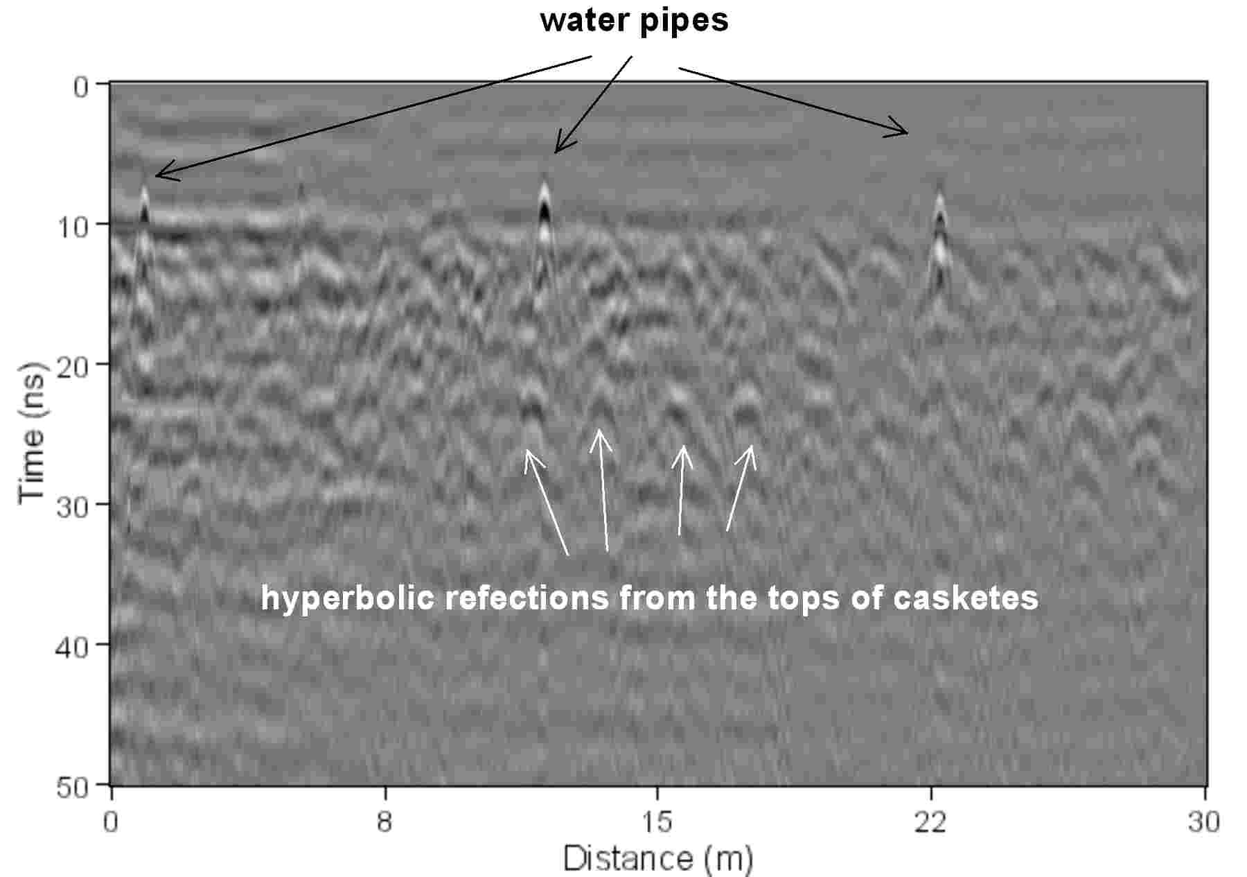
a test of basalt soils on the leeward side of the island GPR reflection profiles
were collected at the National Memorial Cemetery of the Pacific, also called
Punchbowl Cemetery where metal caskets were known to be located at standard
depths in the ground. No coherent
reflections were obtained below 20 nanoseconds (80 centimeters) in any of the
profiles, and none of the caskets, whose tops were about 120-150 centimeters
below ground surface were visible.
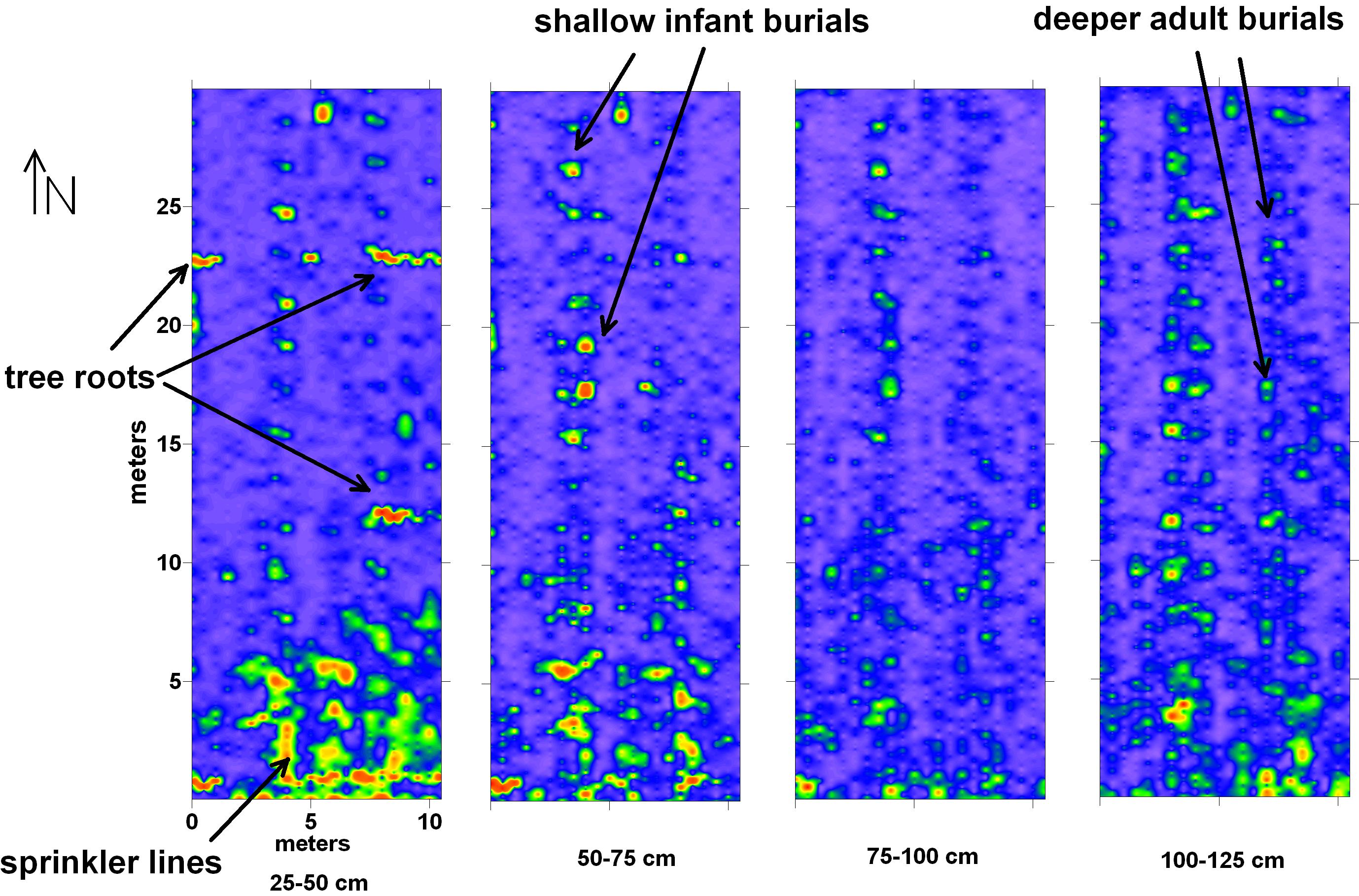
Tests were conducted soils formed on basalt parent material were
performed at the
Amplitude slice-maps of a portion of the cemetery where child burials were located (at various depths) were constructed in order to map individual graves and other buried features:
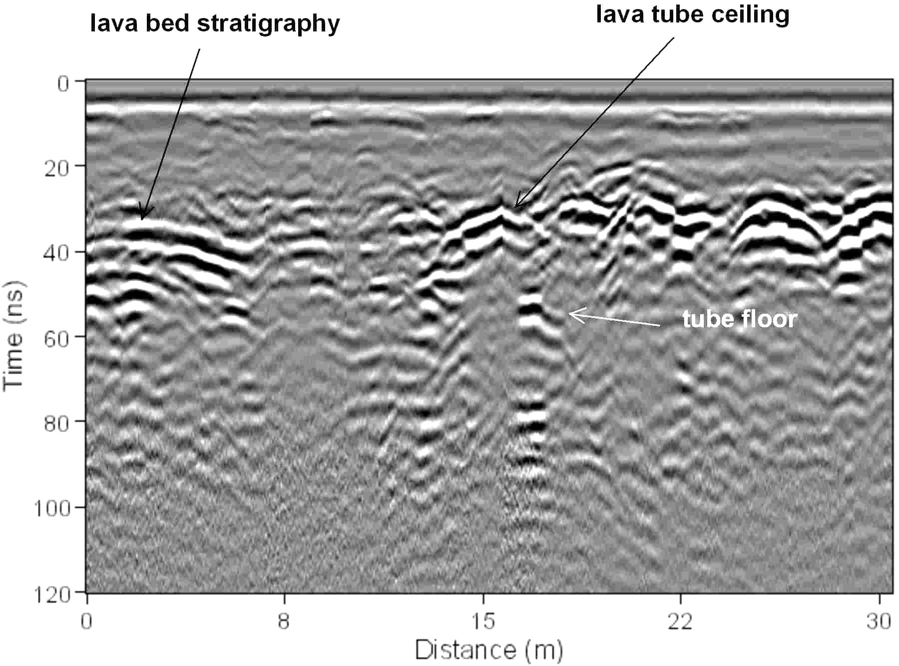
Basalt
rock: lava tubes
In tests using the 270 MHz antennas in 5,000 year old basalt flows on
the