 .
.
Ancient pit houses are
really super targets for GPR, since their floors are nice horizontal layers, and
they are usually buried by material such as river alluvium and windblown sand..
In GPR profiles they appear as horizontal or slightly concave
upward layers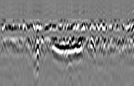
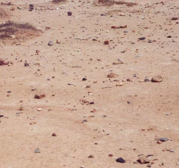
At one site in Utah we were sure there was a pit house village
nearby because the ground was littered with ceramics and lithic debris.
The profiles immediately showed the pit house floors as the
antenna passed over them.

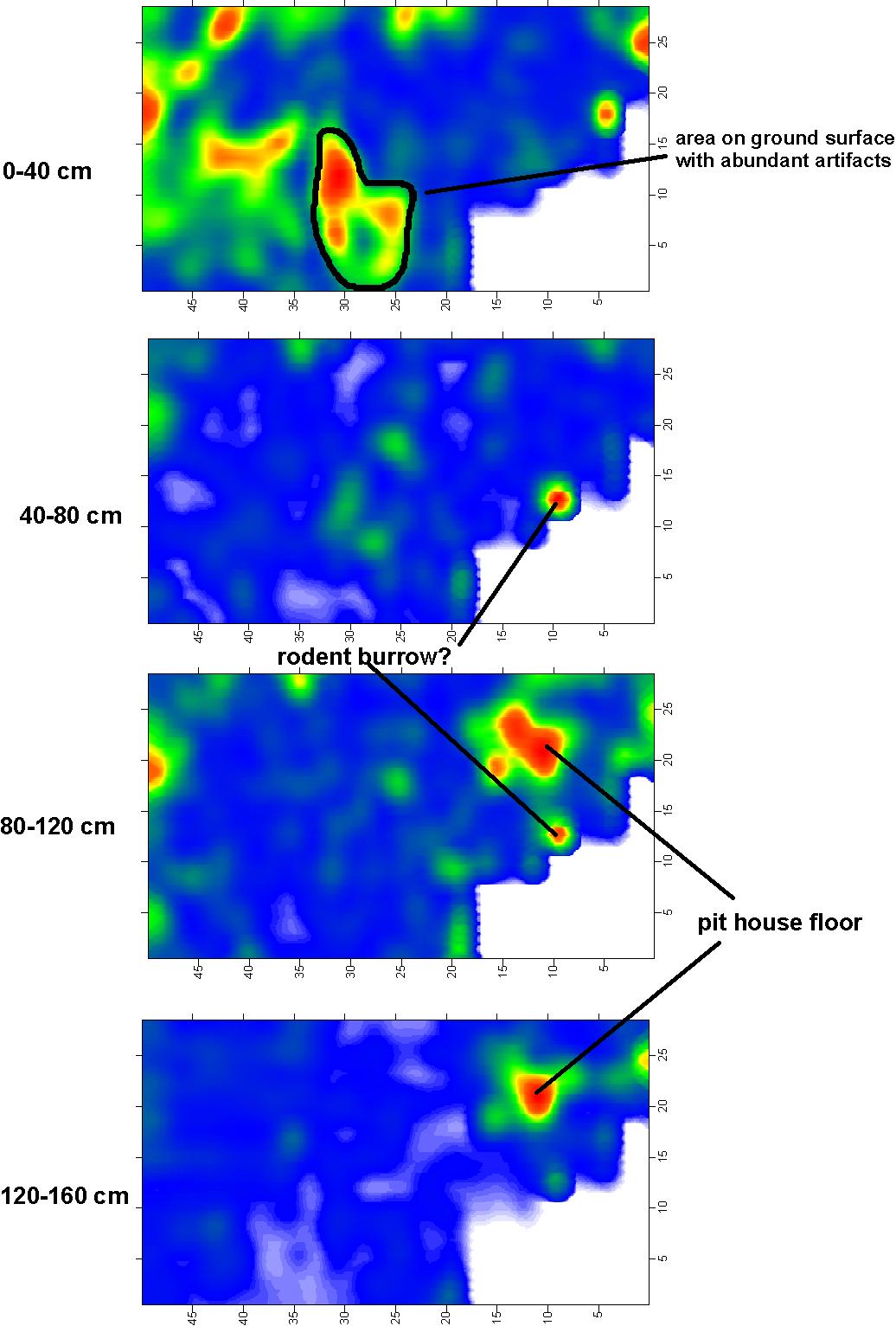
When amplitude time-slices were made, the floor was visible in
map view.
 .
.
The most interesting part of this study was that the surface artifact scatters were in a completely different location than the house that was found by GPR! This is probably because rodents had dug into the floor, bringing up the artifacts, which were then washed around into low areas during rain storms.
In southern Arizona and New Mexico pit house villages are
typically discovered by random trenching, which is not only very destructive,
but cannot locate any of the features located between the
trenches.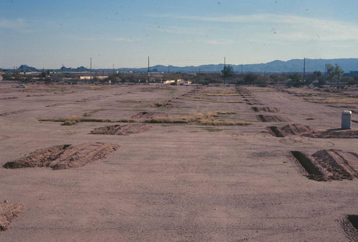 .
.
The resulting maps of this kind of destructive archaeology
look like this: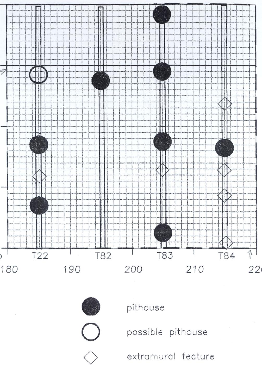
So we did a test and found that GPR could quickly locate all
the pit house floors known from the trenches, but even more located between the
trenches!
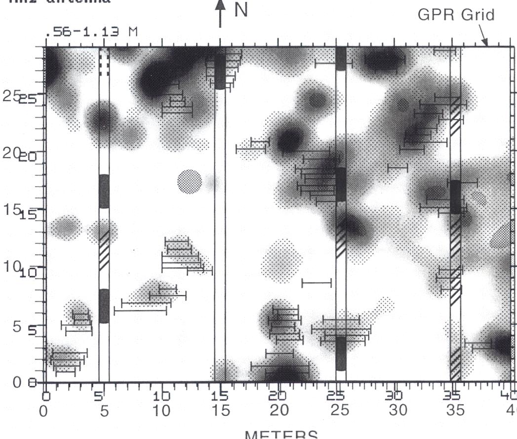
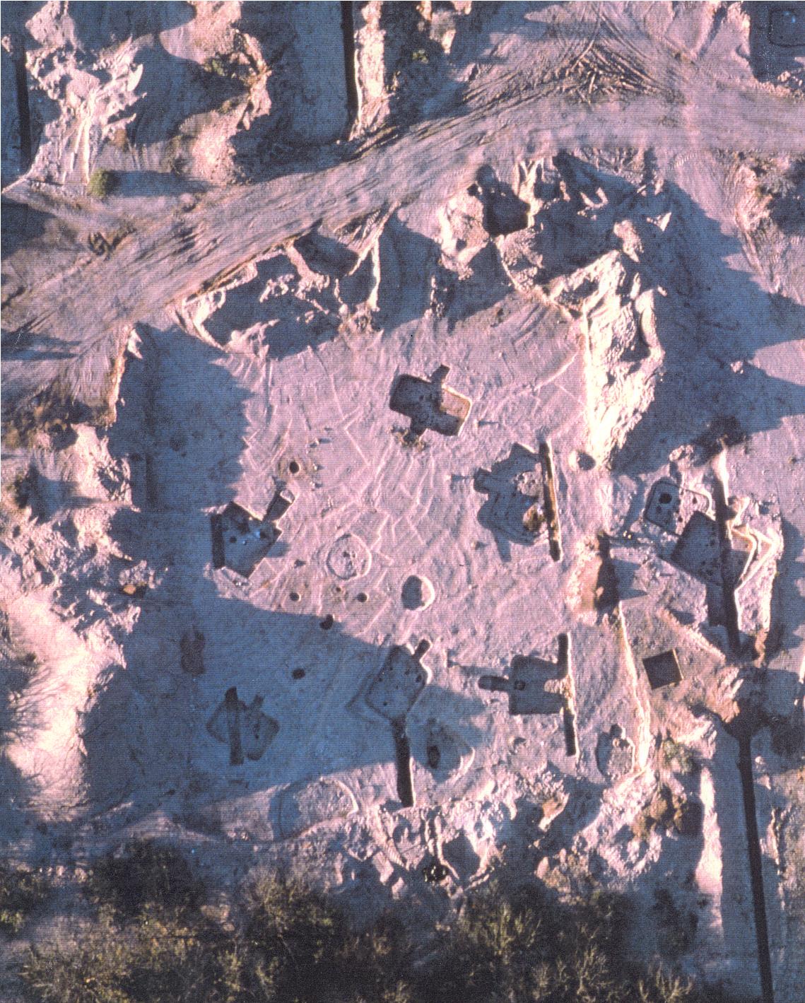
When the area was stripped by front end loaders, the pit house floors were right where the GPR said they would be!
I have published both these pit house floor studies:
Finding Buried Archaeological Features in the American Southwest: New Ground-penetrating radar techniques and three-dimensional computer mapping: Journal of Field Archaeology, v. 25, n. 4.
And the soon to be published:
Ground-penetrating Radar Techniques and Three-dimensional Computer Mapping at the Valencia Site in Roots of Sedentism: Archaeological Excavations at Valencia Vieja, a Founding Village in the Tucson Basin of Southern Arizona. Anthropological Papers No. 29, Center for Desert Archaeology, Tucson, Arizona.