 We found that energy was actually moving through these limestone cobbles, and a
distinct reflection was being generated from the bedrock below.
We found that energy was actually moving through these limestone cobbles, and a
distinct reflection was being generated from the bedrock below.
GPR and EM (Electromagnetic Conductivity) in Portugal
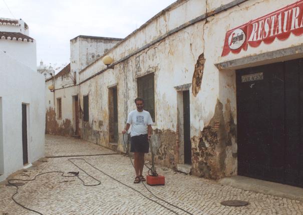
In the summer of 2002 I was fortunate to go to Portugal to work on Phoenician sites along the estuaries with the Texas A&M Institute of Nautical Archaeology. One of the first projects was to find a harbor at Castro Marim, a village on the Algarve Coast. Unfortunately, the village has built up around where the site was, so we had to collect data through the cobblestone pavement!
We found that energy was actually moving through these limestone cobbles, and a
distinct reflection was being generated from the bedrock below.
![]() . The edge of the harbor was then mapped, and unfortunately modern buildings
covered the prospective area.
. The edge of the harbor was then mapped, and unfortunately modern buildings
covered the prospective area.
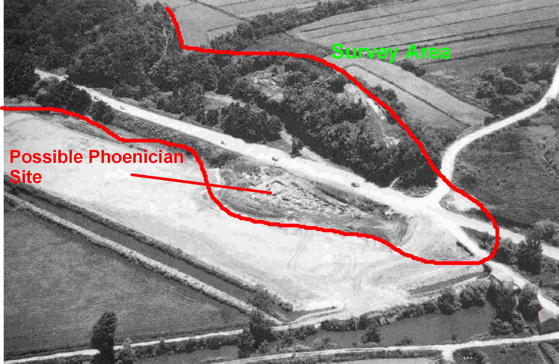
We then moved north along the Atlantic coast to explore for harbors in other prospective areas. Here is the site of Santa Olia from the air, showing the possible harbor, now silted in and used for rice farming.
 We tried to collect data with the EM-38, which works well in conductive ground
(flooded rice paddies!), but found that wading around with it was cumbersome and
time consuming.
We tried to collect data with the EM-38, which works well in conductive ground
(flooded rice paddies!), but found that wading around with it was cumbersome and
time consuming.
 .
So we instead mounted the system in an inflatable canoe.
.
So we instead mounted the system in an inflatable canoe.
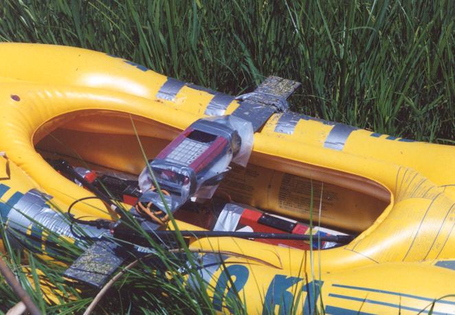 and pulled the canoe across the rice fields with a rope on each end
 .
The data were REALLY nice, and yielded some great maps and images of the ancient
harbors below the flooded fields. Here is one that shows a number of
anomalous areas on the edge of what appears to be the harbor.
.
The data were REALLY nice, and yielded some great maps and images of the ancient
harbors below the flooded fields. Here is one that shows a number of
anomalous areas on the edge of what appears to be the harbor.
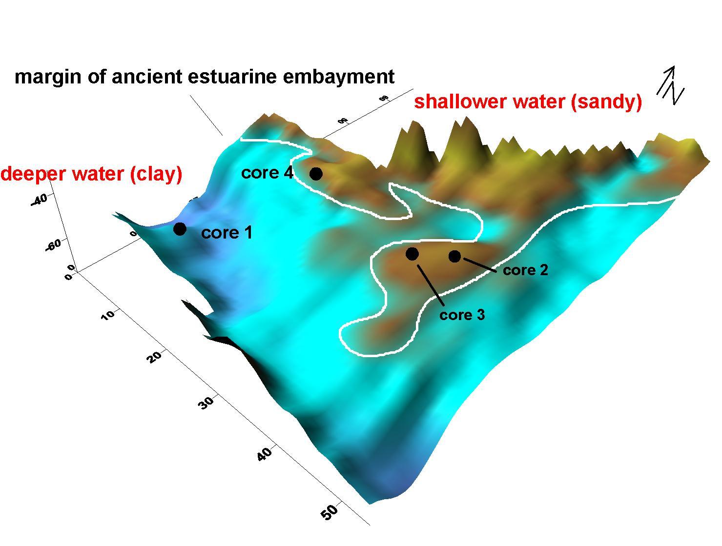 .
We cored the area in a number of places and found the deeper water clay where
the EM maps showed. Most importantly, the anomalous areas along the edge
of the embayment were found to be small shell-rich concentrations (beaches?)
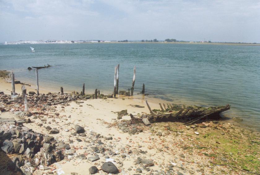
that had pieces of fired ceramics and worked oak fragments (the remains of
sunken boats perhaps?). We think these features are most likely analogous
to this more recent derelict ship along the Portuguese coast
.
We cored the area in a number of places and found the deeper water clay where
the EM maps showed. Most importantly, the anomalous areas along the edge
of the embayment were found to be small shell-rich concentrations (beaches?)
that had pieces of fired ceramics and worked oak fragments (the remains of
sunken boats perhaps?). We think these features are most likely analogous
to this more recent derelict ship along the Portuguese coast