
What you can see in two-dimensional reflection profiles:
Reflection profiles are the primary data source for all GPR processing. They can be used to interpret what is in the ground during data collection. In this profile you can see many interesting buried features, some archaeological and some recent disturbance:
We mostly view profiles in shades of gray, as the human eye
can discern subtle changes better than with more complex colors.

Here is a buried tunnel from a Kofun Period burial mound in Japan:
Often GPR data are very "noisy, and reflections from within the ground are obscured with horizontal banding, produced from interference by other electronic equipment, such as cell phones and radio transmissions.

This is a profile collected with a 500 MHz antenna in downtown Tucson, Arizona. It is virtually worthless! But when I took this profile and removed the background noise, and filtered the frequencies above 650 MHz out of the signal, look how clean it is! And look at the pit-house floor that is visible:

There are many other interesting things that can be seen in
profiles. Here is what an historic trash midden looks like at the Pio Pico
site in Whittier, California.

There were many bottles, cans and other debris tossed off the edge of the San Gabriel River terrace in the 1840s, and in the GPR profile you can see not only the edge of the terrace (shown in blue), but also small hyperbolic reflections from each of the metal and ceramic pieces in the base of this river channel. The area just to the right of the debris (where the blue line disappears) is where a water line trench truncated the stratigraphic horizons.
In El Salvador I was really interested to see that with the
300 MHz antennas we could see ridges and furrows in a Classic Mayan corn field.
![]() This field is buried about 3 meters under volcanic ash, and nearby excavations
showed the top of the soil layer nicely. The soil is the lighter material
below, and the volcanic tephra overlies it. On GPR profiles these furrows
show up as high and low amplitude reflections along this horizon.
This field is buried about 3 meters under volcanic ash, and nearby excavations
showed the top of the soil layer nicely. The soil is the lighter material
below, and the volcanic tephra overlies it. On GPR profiles these furrows
show up as high and low amplitude reflections along this horizon.
 With
the 300 MHz antenna the resolution at 3 meters is not great enough to see the
actual elevation change on the furrows, but you can see amplitude changes where
the energy is either focuses and creates higher amplitudes (concave upward in
the furrows) or disperses from the ridges (convex upward areas).
With
the 300 MHz antenna the resolution at 3 meters is not great enough to see the
actual elevation change on the furrows, but you can see amplitude changes where
the energy is either focuses and creates higher amplitudes (concave upward in
the furrows) or disperses from the ridges (convex upward areas).
Once we had to collect GPR data through a street in downtown
Reno, Nevada (had to wait for the stoplights to change so as not to get run over
by gambler's busses!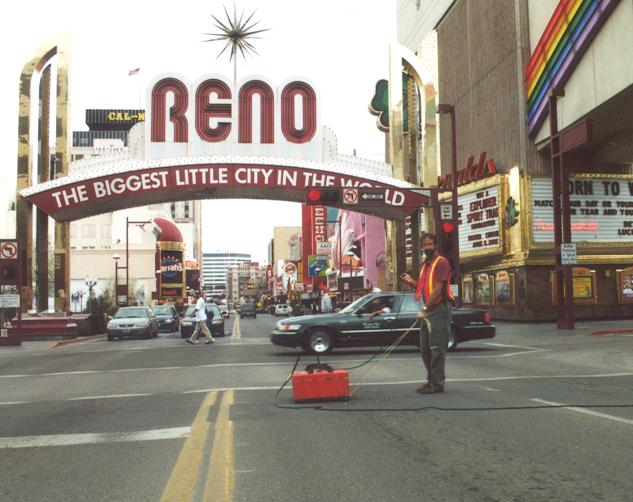
Where there was concrete on the surface with wire mesh, each
metal piece was visible as a reflection hyperbola.
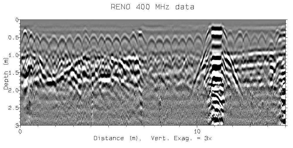
But even so, energy got through and we could see strata
below the concrete. Notice the trench on the left side of the profile.
The multiple reflections on the right are from a manhole cover, that created
multiple reflections through the record. Here is the profile that is parallel to
the one above about 50 centimeters away.

In this area there was only asphalt on the surface and the energy got to the depth necessary to see the trench with must better definition. Even so, I am amazed how well we could use GPR to map these strata, even with all the surface metal obstructions.
Before interpreting any profiles it is important to determine
the velocity of radar energy in the ground. The easiest way to do this is
to put a piece of metal in the side of a road cut, outcrop or trench, and
measure its distance below the surface. These types of metal objects are
visible as reflection hyperbolas and their reflection's times can be measured,
allowing the velocity to be calculated. The bar in the ground is to the
left with a pit feature faintly visible above and to the right of it.![]()
Very subtle layering can be visible in profiles, such as this calcium carbonate rich soil layer, from a site on the University of Denver campus:
![]()
Here is an interesting profile across a Mogollon Period pit
house in Alamogordo, New Mexico, which was truncated by at least one trench to
bury water pipes.
When the ground is not level, you must adjust profiles for
topography, so the real nature of the buried stratigraphy can be seen. In
this profile the distinct layer becomes attenuated as it is buried by
increasingly think overburden.![]()