
Ground-penetrating radar (GPR)
is a
near-surface geophysical method that can identify and
map archaeological features and related stratigraphy in three dimensions.
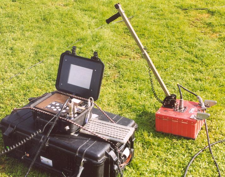
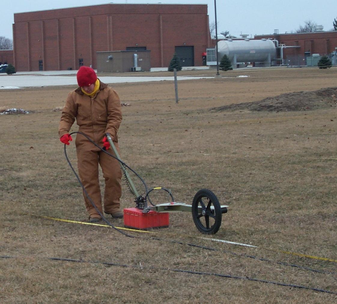
Surveys are accomplished by towing a radar antenna along the ground surface
.
Radar
radar waves are sent into the ground from a surface
antenna.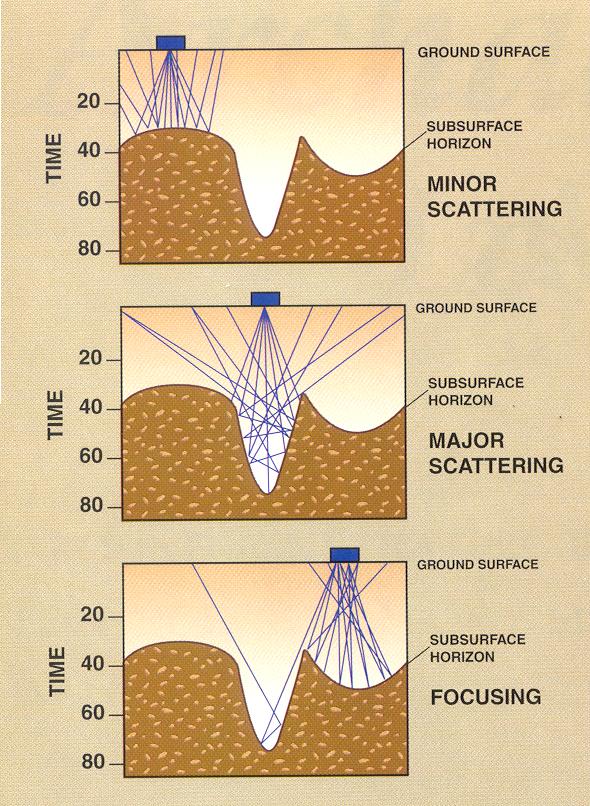
As radar energy is reflected off of underground discontinuities a portion of the energy is reflected back to the surface and measured at another receiving antenna. The radar travel times are measured and stored digitally on a computer.
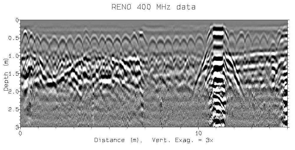
The result of one radar traverse is a
two-dimensional cross section 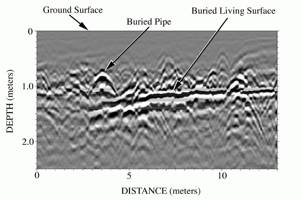 .
.
Resolution down to more than 6 meters in some locations. As many transects are conducted in a grid and subsurface features are identified, important archaeological features are visible.
Radar pulses are generated, and data
are collected in a portable system.
 .
.
I use Geophysical Survey System Inc. equipment (GSSI), but there are a number of other suppliers of equipment including Sensors and Software based in Canada and Mala Inc. from Sweden.
There are many ways that the data are then processed, to make a number of images and maps that can show what is below the surface.
Ground-penetrating radar works best in sandy and silty soils and sediments that are not saturated with water. The method does not work at all in areas where soils are saturated with salt water because this media is electrically conductive and "conducts away" the radar energy before it can be reflected in the ground. People have always thought that ground-penetrating radar can only be used in completely dry areas, but recent studies I have done show that good reflections can even be produced in saturated ground and even saturated clay!
I have also collected great data through
concrete and asphalt.
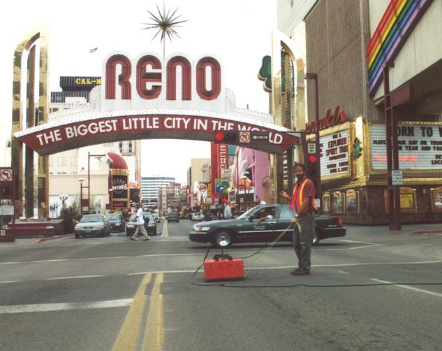
These data sets collected through surface pavement are often superior because the ground below the pavement is usually
dry, the antennas "couple" well with the ground, and a better signal is
transmitted to depth. Also data collected when the ground is frozen
produces great reflections, for many of the same reasons.
Surveys are usually made in grids that are 50x50 meters or less. (My largest grid to date is 150 meters by 95 meters in Guatemala-it took 3 days to collect) A 50x50 meter grid usually takes about a day to collect in the field, with one meter or less line spacing. The data can be processed that evening, but usually I figure another day after getting home from the field to get final results. Some "first pass" types of interpretation can usually be made while the data are still being collected in the field but I am always worried about doing this.
It is often important to model what is in the ground prior to
collection, so one can know what the features should look like. Models are
produced on the computer using software developed by Dean Goodman called
GPR_Sim.
The models look like this:
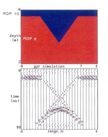 It is as very simple model of the ground that shows how different GPR profiles
look from the "real world". We have been doing much more of this kind of
work recently as we are just beginning to understand how complex the ground is,
and how that complexity affects radar transmission, attenuation and reflection.
This is a very complicated model of the subsurface, recently done by Dean to
show what burials look like in the ground.
It is as very simple model of the ground that shows how different GPR profiles
look from the "real world". We have been doing much more of this kind of
work recently as we are just beginning to understand how complex the ground is,
and how that complexity affects radar transmission, attenuation and reflection.
This is a very complicated model of the subsurface, recently done by Dean to
show what burials look like in the ground.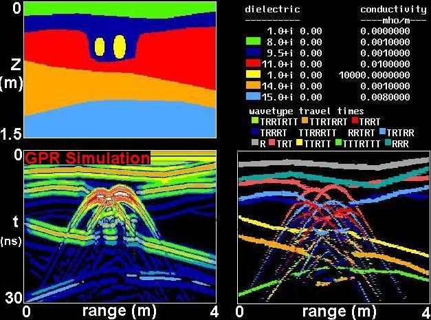