Notes

The Plough Boy Journals

The Journals and Associated Documents

The Plough Boy Anthology

19th Century American Whaling

Bonin Islands

Pitcairn's Island

The Collected Works of William Hussey Macy

The Seizure of the Whaleship George Howland of New Bedford, by Convicts at Charles Island, Galapagos, March 1852

The Documents

1827-1830 Journal

First page (Image)

Illustration (Image)

Transcription/Text

1830-1834 Journal

First page (Image)

Maloney fragment

Transcription/Text

Certificate

Lewis Monto's Seaman's Certificate

Boat Signals

Plough Boy's Boat Signals

Coastal Views

   Ascension Island

   Bonin Islands

   Boning Islands

   Diego Ramirez

   Ferdinand Noronha

   Martin Vass

   Pitcairns Island

   Sandwich Islands

      Oahu

      Oreehoua

   Society Islands

      Eimeo

      Otaheita

   Sulpher Islands

Fragments

Honolulu Note 1828

Honolulu Note 1829

Related Material

Sailing Vessel Identification

Types of Sailing Vessels

The Ship

Spars and Rigging

A Ship's Sails

Frame of a Ship

A Whaling Vessel

Deck Plan

Side/Interior

A Whale Boat

Whale Boat

Stores

      Whale-Ship Stores

Dictionaries & Glossaries

Ashley's Glossary of
Whaling Terms

Dana's Dictionary of
Sea Terms

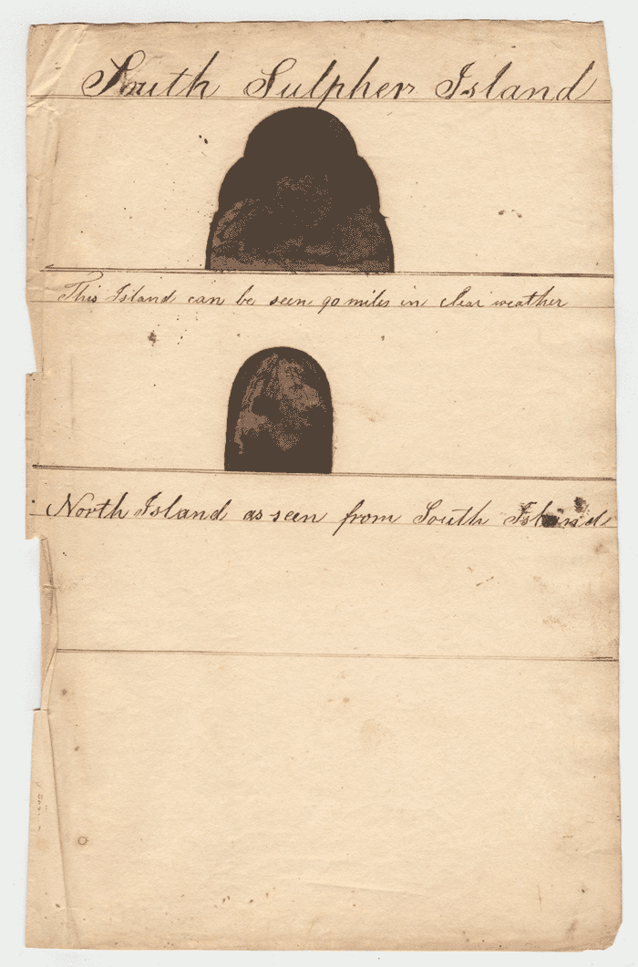
Lewis Monto - Coastal Views of North and South Sulpher Islands, 1832.

Lewis Monto - Coastal Views of North and South Sulpher Islands, 1832.

[Click on image to view in larger format in a new window.]


Annotations:

        Top: "South Sulpher Island"
        "This Island can be seen 90 miles in clear weather"

        Bottom: "North Island"
        "as seen from South Island"

NOTES:

      Lewis Monto's sketches of North and South Islands of the Sulphur Islands group in 1832 originally found in his manuscript journal of the 1828-1830 whaling cruise of the Nantucket whale ship, Plough Boy, Nathan Chase, commander. Monto was an officer on this voyage.

      Missing from Monto's sketches is the middle and most important island of the group -- Iwo Jima. It's absence may be due to the existance at the time of William Bligh's coastal view of Iwo Jima on the admiralty chart of the islands. Bligh's drawing was made on Cook's third voyage. This chart was published in 1785.

      Sulphur Island is now named Iwo Jima. North Island is now named Kita Iwo Jima) and South Island is named Minami Iwo Jima.

      The sketches are now in the collections of the Nantucket Historical Association on the island of Nantucket, Massachusetts.


Last updated by Tom Tyler: September 6, 2018.